Truk, Federated States of Micronesia 1:25,000, USGS, 1983
Permanent URI for this collection
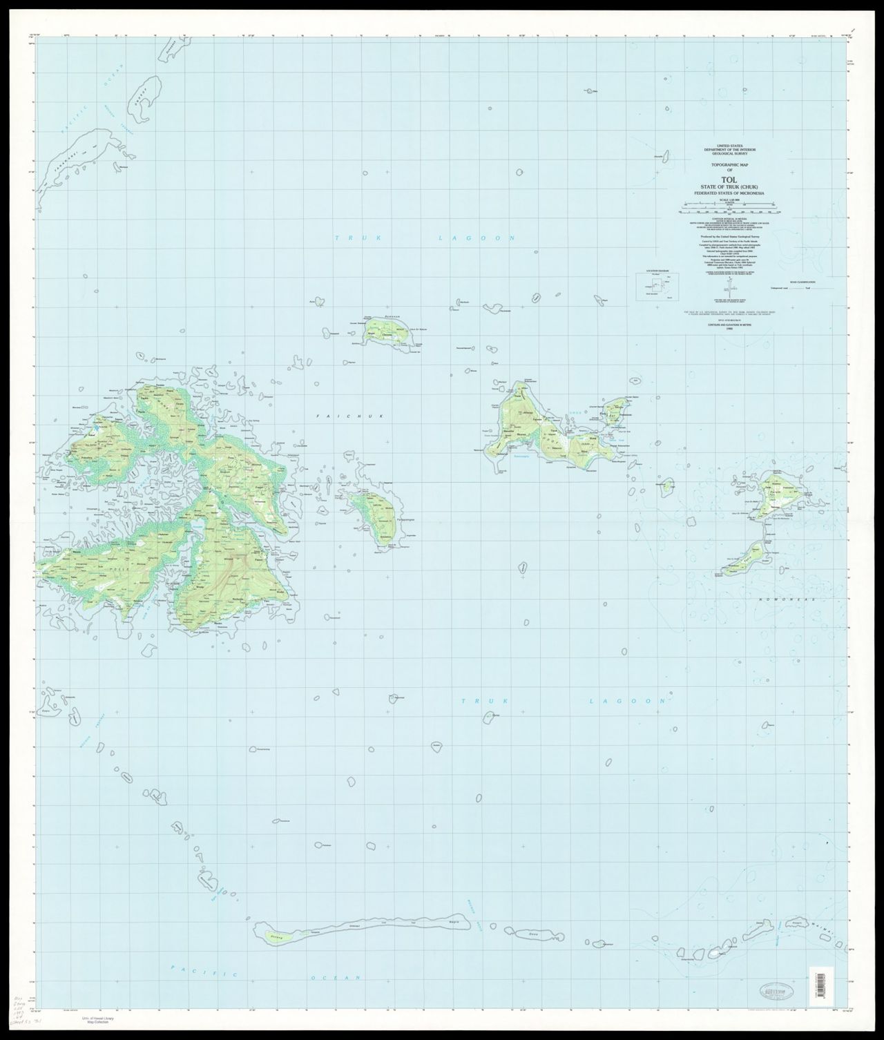
Topographic map of the State of Truk (Chuk), Federated States of Micronesia / produced by the United States Geological Survey. Scale 1:25,000 ; Universal transverse Mercator projection (E 148°58'00"--E 154°01'00"/N 9°11'00"--N 5°04'00"). 6 maps : color ; on sheets 163 x 109 cm or smaller. Topographic maps of Moen, Neoch, Piis Moen, Ruo, and Tol. Relief shown by spot heights. Depths shown by soundings. Contour interval 10 meters. "Compiled by photogrammetric methods from aerial photographs taken 1968 and 1971. Field checked 1980. Map edited 1983." At head of title: United States, Department of the Interior, Geological Survey. Includes location diagram.
Click here for an interactive index map to this set.
For more information, visit Manoa MAGIS
Browse
Recent Submissions
-
ItemTopograhic map of Unikappi, State of Truk (Chuk), Federated States of Micronesia, 1983(Reston, Virginia : U.S. Geological Survey, 1983)
-
ItemTopographic map of Tol : state of Truk (Chuk) : Federated States of Micronesia, 1983(Reston, Virginia : U.S. Geological Survey, 1983)
-
ItemTopographic map of Ruo, State of Truk (Chuk), Federated States of Micronesia, 1983(Reston, Virginia : U.S. Geological Survey, 1983)
-
ItemTopographic map of Piis Moen, State of Truk (Chuk), Federated States of Micronesia, 1983(Reston, Virginia : U.S. Geological Survey, 1983)
-
ItemTopographic map of Neoch, State of Truk (Chuk), Federated States of Micronesia, 1983(Reston, Virginia : U.S. Geological Survey, 1983)
-
ItemTopographic map of Moen, State of Truk (Chuk), Federated States of Micronesia, 1983(Reston, Virginia : U.S. Geological Survey, 1983)